- 402 E. Main Street, Buena Vista CO (719.395.8001)
- BV 9:00 am - 6:00 pm Every Day
Quandary Peak is the highest summit of the Tenmile Range in the rockies and is the most commonly climbed fourteener in Colorado. It has nearly the same elevation as Castle Peak and Mount Blue Sky. Elevation 14,265 feet.
$5.00This fourteener is located in the Mount Evans Wilderness of Pike National Forest, 9.4 miles east of Georgetown. Elevation 14,060 feet.
$5.00The mountain is named in honor of American explorer Zebulon Pike and is higher than any point in the United States east of its longitude. Manitou Springs lies at its base. Elevation 14,110 feet.
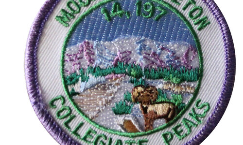
$5.00Mount Princeton is part of the Collegiate Peaks located in San Isabel National Forest near Buena vista. The mountain was named in honor of Princeton University. Elevation 14,197 feet.
$5.00Mount Massive is located near Leadville in the Sawatch Range. Its name comes from its elongated shape: it has five summits, all above 14,000 ft. Elevation 14,421 feet.
$5.00Previously known as Old Baldy, Mount Lindsey is named after Malcolm Lindsey. Located near Fort Garland. Elevation 14,042 feet.
$5.00Mount Democrat is located 5.4 miles northwest of the Town of Alma. It was once known as Republic Mountain and Mount Buckskin. Elevation 14,148 feet.
$5.00Mount Bross is located in Pike National Forest . It is often climbed together with Mount Lincoln and nearby Mount Democrat. Elevation 14,172 feet.
$5.00Mount Antero is prized for its gemstone deposits and has one of the highest concentrations of aquamarine in the country. Elevation 14,269 feet.
$5.00Botanist Charles C. Parry made the first recorded ascent of the summit in 1861 and named the peak in honor of his botanist colleague Asa Gray. Elevation 14,270 feet.
$5.00Pyramid Peak is the 47th highest mountain peak in Colorado, and 78th highest peak in the United States. It is located in the Elk Mountains in southeastern Pitkin County. The summit resembles a ragged square pyramid. Elevation 14,018.
$5.00Show off your love of mountain biking in the rockies with this sweet patch.
$5.00 Shop
Shop


