- 402 E. Main Street, Buena Vista CO (719.395.8001)
- BV 9:00 am - 6:00 pm Every Day


A beginner/ family friendly trail that goes from Winter Park to Fraser. You will have views of the Resort and Fraser River throughout most of the trail. It runs parallel to HWY 40 for the entirety so it is always less than a 5 minute drive if you are in town. Very popular trail for biking, running, hiking, birding, fishing, and cross country skiing in the winter. Dogs are welcome but must be on leash.
DIFFICULTY: Easy
DISTANCE: 13.6 Miles round trip
ELEVATION: 8,579 ft. (if started in Fraser)
ELEVATION GAIN: 688 ft
RECOMMENDED MAP: All Trails app or free come grab a local map in our store.
DIRECTIONS: If starting in Fraser, go to CR 8, and park at the bus stop. The trail starts right there and will go all the way to Winter Park Resort.
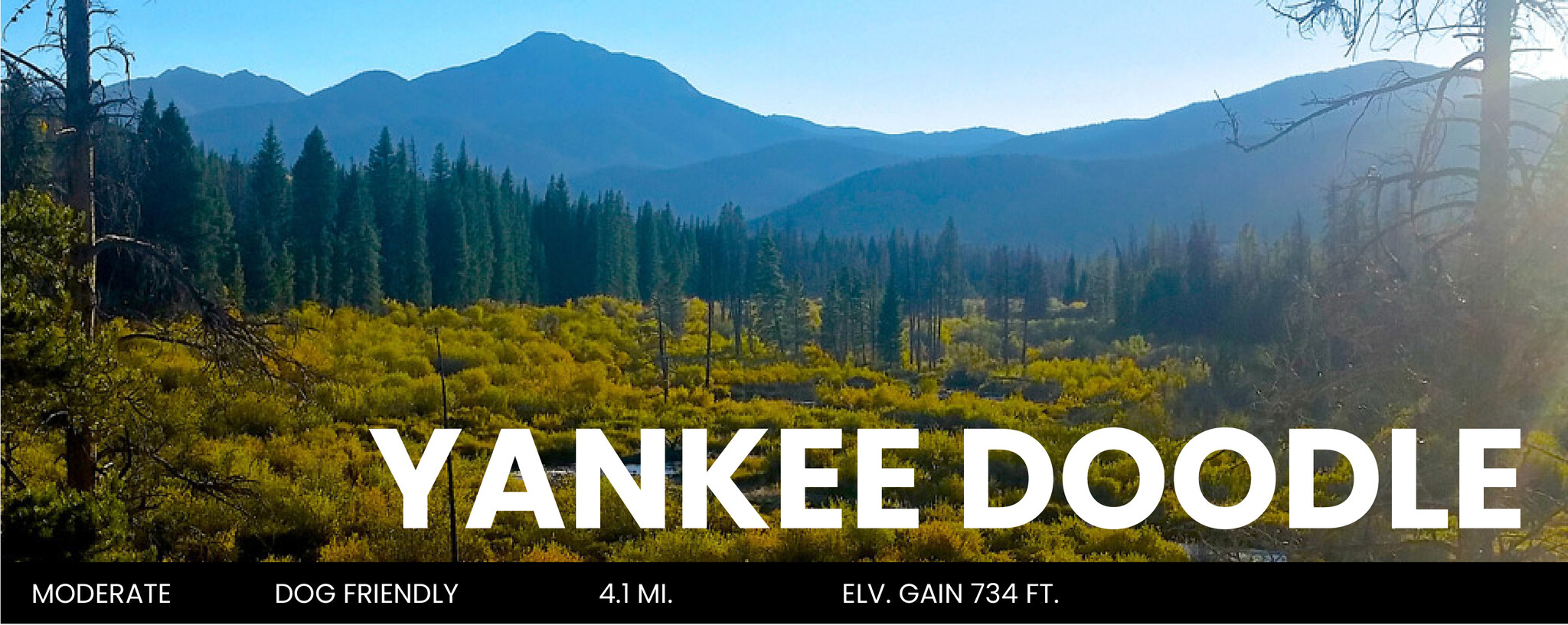
An out and back trail right in Winter Park with stunning views of the valley and WInter Park Resort. Somewhat challenging trail that is still pretty popular for hiking, trail running, and biking. You will likely see other people and wildlife in the area. Dogs can be off leash but be careful of moose.
DIFFICULTY: Moderate
DISTANCE: 4.1 Miles round trip
ELEVATION: 9,121 ft.
ELEVATION GAIN: 734 ft.
RECOMMENDED MAP: All Trails app or come grab a free local map in our store.
DIRECTIONS: Turn on the Rendezvous Road (Before the fire station between Winter Park and Fraser) follow that road until you can turn right on Ski Idlewild Road. You’ll drive that road for a short while until you find a parking lot on your right and the Trailhead is on the other side of the road.

15 minutes from Winter Park this is a loop trail that is a staff favorite. Great views and great trail for biking, hiking, running, or leaf peeping in the fall. This trail is great for beginner bikers or family rides. You will likely encounter people and wildlife on this trail such as deer, elk, and sometimes moose. Dogs are welcome and can be off leash. Great for a quick look if you don’t have time for an all day hike.
DIFFICULTY: Moderate
DISTANCE: 4.5 Miles round trip
ELEVATION: 8,579 ft.
ELEVATION GAIN: 639 ft
RECOMMENDED MAP: All Trails app or come grab a free local map in our store.
DIRECTIONS: Take a right on CR 72 (This is the stoplight by Wendys/Murdochs) it will turn in to gravel under a bridge make sure to stay left and follow this road until you come to a trailhead on your left. The trail will start on the other side of the road.

This trail is a popular hike for the views and length of the hike. Perfect for a day hike if you are wanting a challenge. There is a 1.9 mile 4x4 road that is closed to vehicles but can be biked or hiked to get to the Byers Peak Trailhead. You can lock your bike up at this trailhead. From there the trail is steep and mostly above tree line. You will have to do some light bouldering when you get to the top. The trail is clearly marked throughout but you might encounter some snow fields throughout the summer. (We would only recommend doing this in the summer months due to road closures) Pets must be on leash.
DIFFICULTY: Hard
DISTANCE: 4.4 miles
ELEVATION: 12,804 ft.
ELEVATION GAIN: 2,024 ft.
RECOMMENDED MAP: All Trails app or a National Geographic Winter Park Map.
DIRECTIONS: Take a right on CR 72 (This is the stoplight by Wendys/Murdochs) it will turn into gravel under a bridge make sure to stay right and follow this road past the tubing hills until you come to a stop sign- turn left onto CR 73. Drive this road through the Fraser Experimental forest towards the campgrounds. Take a sharp right at the byers peak sign and follow this dirt road for 2 miles to the gate and the Byers Peak Trailhead parking area.

A great 6.8 mile day hike. Family and dog friendly destination on the west side of the Indian Peaks Wilderness. Very well groomed and marked trail. You will hike to a beautiful alpine lake with breathtaking views for a snack break. You will need a day pass for parking that you can purchase on the road to the trailhead. The road to get to the trailhead is a non-maintained dirt road and clearance is recommended. It is about a 45 minute drive from town.
DIFFICULTY: Moderate
DISTANCE: 6.8 Miles round trip
ELEVATION: 11,060 ft.
ELEVATION GAIN: 972 ft.
RECOMMENDED MAP: All Trails app, a National Geographic Winter Park Map, or come grab a free local map in our store.
DIRECTIONS: Take 40 HWY past Fraser. There will be a right (CO HWY 83) Take a left when the road splits ( County HWY 84 or Creek 84) drive that the whole way until it veers left again by the reservoir. Keep driving the the trailhead will be on your left.)